Red Canyon
Dixie
Utah
Date filmed:2024-05-19
Number of sites:38
GPS:37.7436885, -112.3106995
Max vehicle length:50 Feet
Check in:2:00 pm
Check out:11:00 am
Quiet hours:10:00 pm - 6:00 am

Amenities and Activities

Amenities
Drinking Water
Fire Ring
Picnic Table
RVs
Tents
Showers
Flushing Toilets
Trash Collection
Shade
Dump Station
Water Spigot
Grill
Host
Activities
Hiking
Mountain Biking
Biking
Scenic Driving
Star Gazing
Bird Watching
Wildlife Viewing
Photography
Picnicking

Things to Do

Bryce Canyon's Figure 8 Loop Trail

A Hike Through Fantasy

Featured: North, Sunset, Red Canyon

Bryce Canyon is one of the most unique landscapes in the world. One of the great things about it is that you can configure many different hiking routes throughout the park, and the Figure 8 Loop might just be one of the best configurations to experience. In this episode, we explore scenic Bryce Canyon for the very first time. We opted to hike something known as the Figure 8 Combination Loop, which chains together the Queens Garden Loop, Navajo Loop, and the Peekaboo Loop trails, resulting in a 6.4-mile hike through some of Bryce Canyon's most iconic terrain. We found that this particular hiking configuration resulted in an experience that allowed us to sample the best that Bryce has to offer, letting us get up close and personal with the famous rock formations, known as hoodoos, as well as other interesting features inside of the canyon. The hike was not very strenuous and only took a few hours, meaning that there was plenty of time left to do other things in the park, such as tour some of the best overlooks such as Sunrise, Sunset, and Bryce points, and to casually stroll up on the rim for some amazing views and photographic opportunities. The hike was not very strenuous (in our opinion), as the canyon is not very deep (compared to others we've hiked like the Grand Canyon or some trails in nearby Zion National Park). The trail is also one of the smoothest and best-maintained trails out of any national park we've been to in recent times. Some of the highlights from this hike were the Peekaboo loop, which was less crowded than Queens Garden, and the Wall Street portion of the Navajo Loop. Not only does Peekaboo seem to provide better seclusion, we feel that the hoodoos and vistas on the Peekaboo loop rival those of Queens Garden, the park's most popular trail, giving the hiker the best of both worlds... amazing views as well as peace and serenity! One feature we enjoyed about the 65 miles of hiking trails at Bryce Canyon is that the various hikes are highly configurable and can be done in many different ways, at many different lengths, giving people of all ages and fitness levels the opportunity to experience Bryce Canyon up close and personal. We thought that the paved sections of the rim trail that we experienced were among the most accessible, immaculate paths we've ever walked at any National Park. Bryce Canyon is one of the most unique landscapes we've ever seen. It is other-worldly, and we sincerely hope that you have the opportunity to experience this marvelous place at least once in your life!

A Bryce Canyon Morning Hike

Seeing How Crowded a Popular Trail is at Sunrise

Featured: Escalante Petrified Forest, North, Sunset, Red Canyon

Bryce Canyon is a majestic place, but add in some golden hour sunrise lighting while hiking the Queen's Garden Loop and you have something that is bucket list-worthy. You have not lived until you see this for yourself! Queen’s Garden Trail has some of the most stunning views of the many hoodoos within the Bryce Canyon amphitheater. These hoodoos are the trademark of Bryce Canyon National Park and what it is known for. The trail is also one of the more popular ones in the park so the trail is well maintained and easy to follow. At 3.2-miles, this hike can be easily be completed in a day with plenty of time to spare. The Wall Street section of Bryce Canyon is something you just have to see for yourself. After making your way through clusters of hoodoos and a forest of trees, you will be met with an impressive almost slot-canyon-like entrance that rises back up to the rim. It is impressive and an unforgettable experience. The choice is really up to you. While hiking counter-clockwise does have its advantage of descending down Wall Street’s switchbacks, most don’t consider the gradual inclines to be too difficult. Many reviews note that children do not have a hard time with them either. Don’t be fooled though! You will still have to climb back up in elevation through Queen’s Garden Trail. The advantage of hiking clockwise really lies in the time one starts hiking. If one starts hiking clockwise at sunrise, the sun illuminates the hoodoos within the amphitheater with amazing golden light and will continue to rise to light up the Wall Street area in magnificent ways throughout the hike. If you need proof for yourself, you can see our video for what to expect on this early morning hike.

Hidden Utah

Arches Trail at Losee Canyon

Featured: Cedar Canyon, Duck Creek, Point Supreme, Spruces, Sunset, White Bridge, Red Canyon

Utah has no shortage of red rocks and arches but with those comes a lot of crowds. Arches Trail in Red Canyon offers a lot of Bryce Canyon sights in a small area with plenty of space to call your own. The landscape around Bryce Canyon National Park in Southern Utah is a wonderland and playground for adventurers. While nearby Bryce Canyon is well known, the caveat to that is the crowds that go along with it. Parking can be hard to find if one doesn’t arrive early, trails can be congested and campsites can go quickly. What if you were told that there is an alternative not too far away from Bryce Canyon where you might have almost complete solitude? What if you were told that some of those well-known features of Utah Parks, hoodoos, arches, and vibrant red rock were available to you packed into a short loop trail that requires little effort? Arches Trail offers all that with some spectacular views. Arches Trail in Red Canyon is a 0.6-mile loop trail that wanders around brilliant red rock with sights of several small arches and hoodoos. The well-maintained trail does have an elevation of about 187 feet, however, the trail is rated as easy, and most should be able to navigate it with good hiking shoes and some care in a few areas. The views are incredible and the shortness of the trail makes this trip an easy day trip or side adventure to pack into a day traveling to or from Bryce Canyon. To reach the Arches Trail, turn north off of UT-12 onto Casto Canyon Road. While this road is dirt and gravel, any two-wheel-drive vehicle should be able to make this drive with no problems provides that it hasn’t been raining. A parking lot for this trail, as well as others, will be on the right after two miles. From the parking lot, one merely needs to cross a dry wash and follow the signs for Arches Trail.

Take a scenic ride from Panguitch, Utah to Kodachrome Basin State Park, stopping at Red Canyon, showcasing vibrant red rock landscapes and Mossy Cave, with its Bryce Canyon-like formations and beautiful waterfall. Embark on a relaxed drive from Panguitch, Utah, to Kodachrome Basin State Park, a route filled with striking landscapes and fascinating stops. As you head out from the charming town of Panguitch, your first stop could be the Red Canyon Visitor Center. Nestled along Highway 12, this area offers vibrant red rock formations that preview the dramatic scenery of Southern Utah. Stroll through its easy trails or simply admire the towering hoodoos and cliffs that glow in the sunlight. Continuing your journey, stop by Mossy Cave, a hidden gem that feels like a piece of Bryce Canyon. Here, you’ll find a unique blend of towering red rock spires, a small cave, and a scenic waterfall. Though not lush like its name suggests, the area provides an opportunity for a short, rewarding hike with Bryce-like views and the refreshing sight and sound of flowing water in a desert landscape. The drive then winds through more of Utah's scenic beauty before you arrive at Kodachrome Basin State Park. Known for its colorful, layered rock formations, Kodachrome Basin feels like stepping into a natural painting. The park is perfect for hiking, photography, or simply soaking in the vibrant surroundings. Whether you're spending the day exploring or just passing through, this laid-back drive offers a taste of Southern Utah's natural wonders.

Welcome to the World of Color!

An Exploration of Kodachrome Basin State Park

Featured: Kodachrome Basin, Red Canyon

Aside from the Big 5, Utah has beautiful state parks galore. Located 20 miles southeast of Bryce Canyon is Kodachrome Basin State Park filled with spires, colorful layered sandstone, and great views from narrow overlooks for the more adventurous. Utah is well known for its majestic parks, often called the Big 5 - Bryce Canyon National Park, Zion National Park, Arches National Park, Canyonlands National Park, and Capitol Reef National Park. The natural beauty found in these parks is second to none, however, there are numerous other parks without the national park designation that should not be missed. Located about 30 minutes southeast of Bryce Canyon National Park lies Kodachrome Basin State Park. While smaller in scale, this park still offers plenty of hiking trails, a vast landscape of red rock formations, campgrounds, and various other activities. Popular activities include horseback riding and mountain bike riding along the many trails. Also within the park is an 18-hole disc golf course. Discs can be bought or rented at the Visitor Center. The unique landscape of the park will dazzle visitors as they wander around. Located within are 67 monolithic spires of varying sizes and shapes. Some have unique names guiding the imagination to see varying things such as Ballerina Slipper - what appears to be the leg of a ballerina rising in the air. These spires are likely a result of sediment filling either ancient springs or cracks leftover from seismic activity and then revealed over time after ages of erosion. For a little excitement, there is the Angel’s Palace Trail which leads to some vertigo-inducing overlooks with phenomenal views. After climbing a couple of hundred feet in elevation, one finds themselves with the invitation to walk out onto several narrow portions if they dare. Those with a fear of heights might find their legs wobbly! If you’re unsure if this is for you, our video detailing the experience can be found so you may judge for yourself!

Majestic Color and Majesty

Exploring Kodachrome Basin State Park

Featured: Escalante Petrified Forest, Kodachrome Basin, North, Sunset, Red Canyon

Kodachrome Basin State Park in southern Utah is known for its colorful rock formations and towering spires. This scenic destination offers hiking, photography, and unique geological wonders, perfect for outdoor enthusiasts and nature lovers. Kodachrome Basin State Park, nestled in southern Utah near Bryce Canyon, is a hidden gem that captivates visitors with its strikingly vibrant rock formations. Named after the famous color film due to its dazzling array of red, orange, and white hues, the park is a visual spectacle shaped by millions of years of geological forces. The park’s iconic features include towering sandstone spires known as sedimentary pipes, which rise dramatically from the desert landscape. These formations, some over 170 feet tall, are unique to this region and add to the park's allure. The park offers a range of activities for outdoor enthusiasts. With over 12 miles of hiking trails, visitors can explore narrow canyons, open desert landscapes, and panoramic viewpoints. Popular trails like Angel’s Palace and Panorama Trail offer opportunities to witness the park’s beauty from different vantage points, while the Shakespeare Arch trail takes hikers to one of the park’s few natural arches. The diverse terrain makes it a favorite destination for both casual walkers and experienced hikers looking for scenic adventures. Kodachrome Basin is also a haven for photographers. The park’s vivid colors and dramatic rock formations create an ever-changing canvas, especially during sunrise and sunset, when the light plays on the rocks, enhancing their color. In addition to its geological wonders, the park is home to various wildlife species, including mule deer, coyotes, and numerous bird species, making it a great spot for nature lovers to enjoy both landscape and wildlife photography. Camping in Kodachrome Basin is another highlight for visitors, with well-maintained campgrounds that offer stunning views of the night sky. The park’s remote location means minimal light pollution, allowing for incredible stargazing. Whether you're looking for a day trip or a peaceful retreat into nature, Kodachrome Basin State Park provides a serene escape filled with natural beauty and adventure.

Campground Overview

Red Canyon Campground – Dixie National Forest, Utah

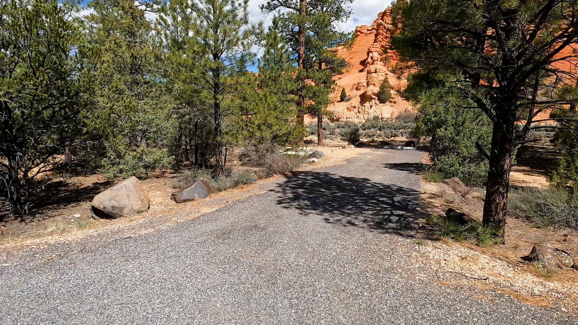
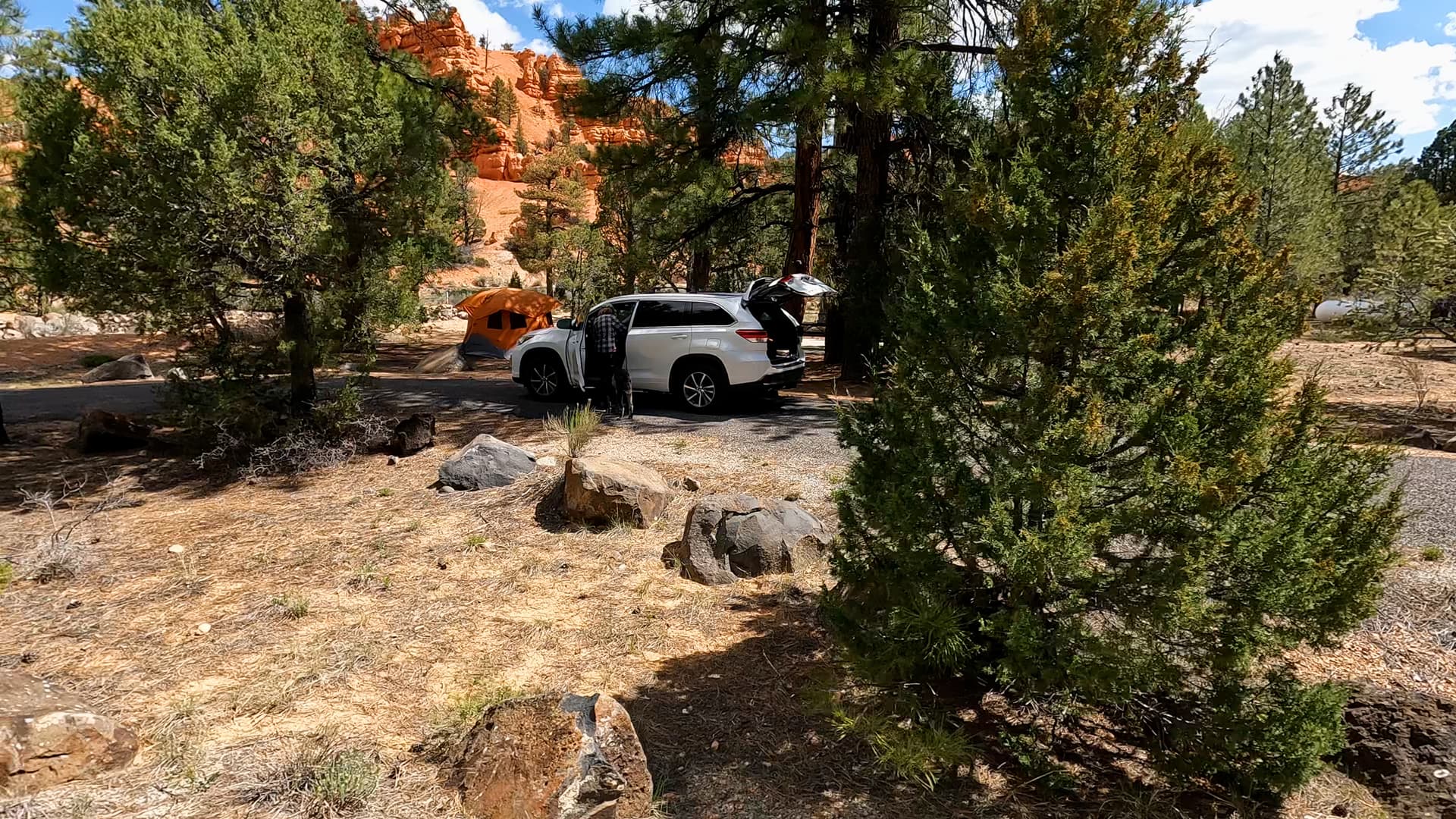
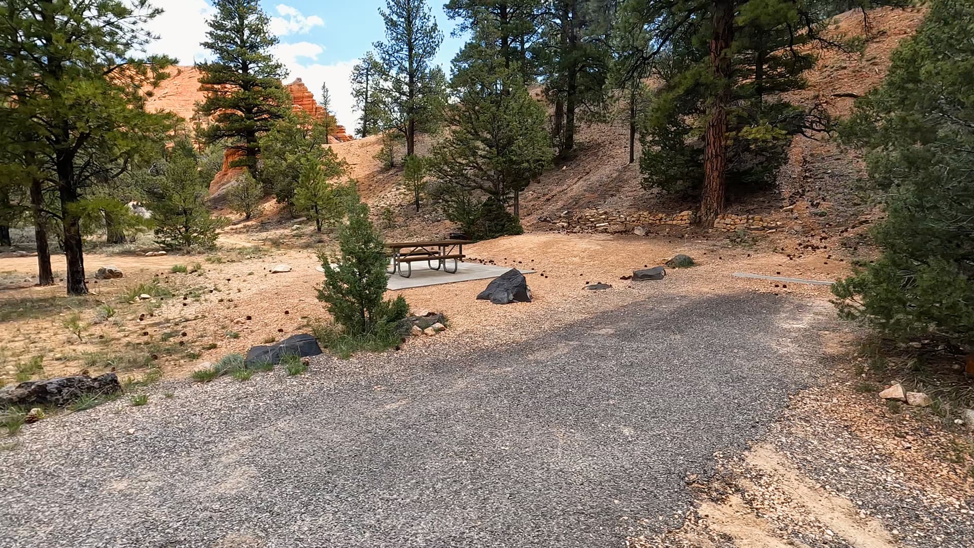
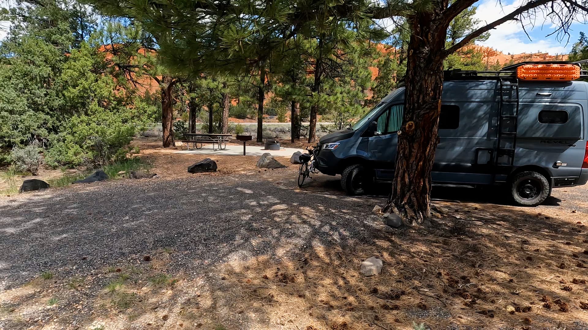
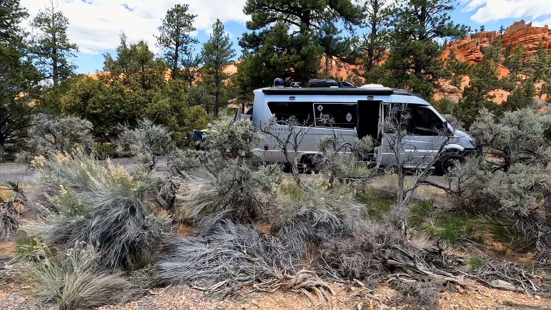
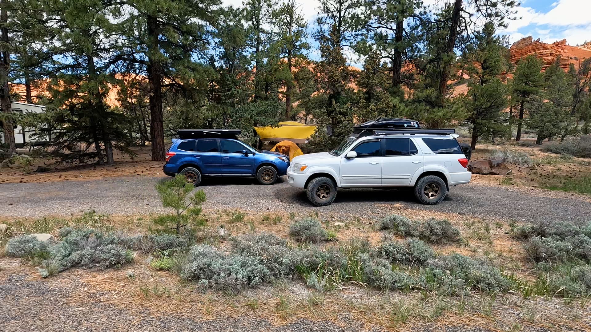
Red Canyon Campground is a forest service campground located within Red Canyon in Dixie National Forest, just west of Bryce Canyon National Park. The campground sits among striking red rock formations and hoodoos similar to those found in nearby Bryce Canyon, offering a scenic setting with easier access and a generally quieter atmosphere. Its location along Scenic Byway 12 makes it a convenient stop for visitors traveling through southern Utah.

Location & Setting

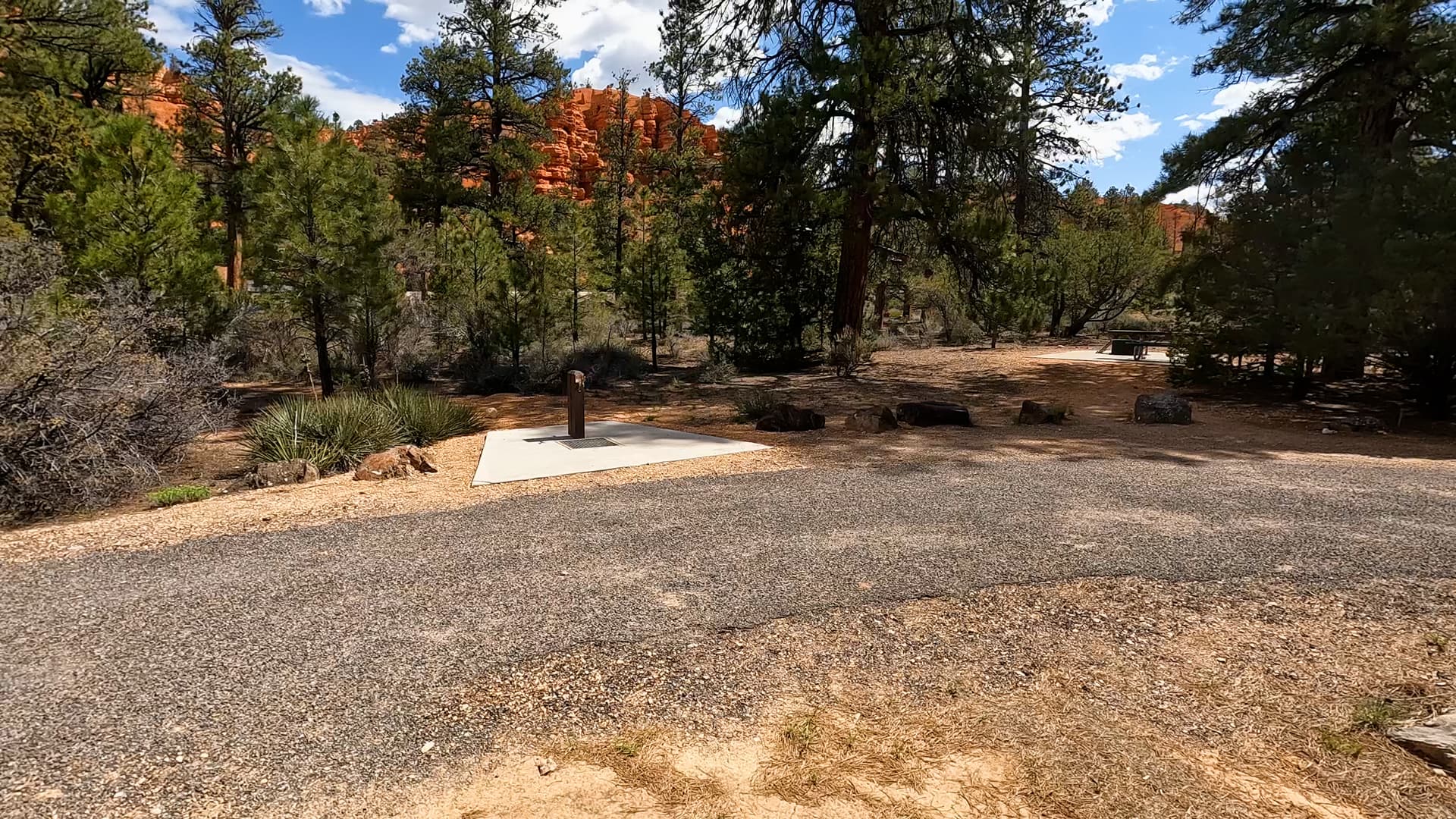
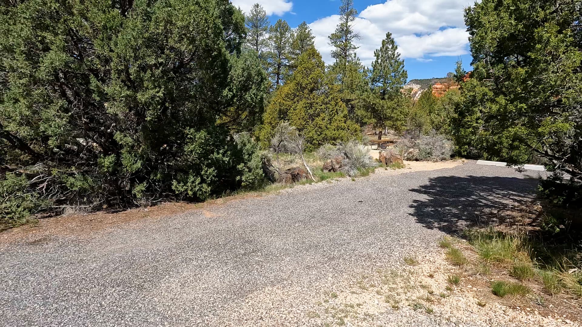
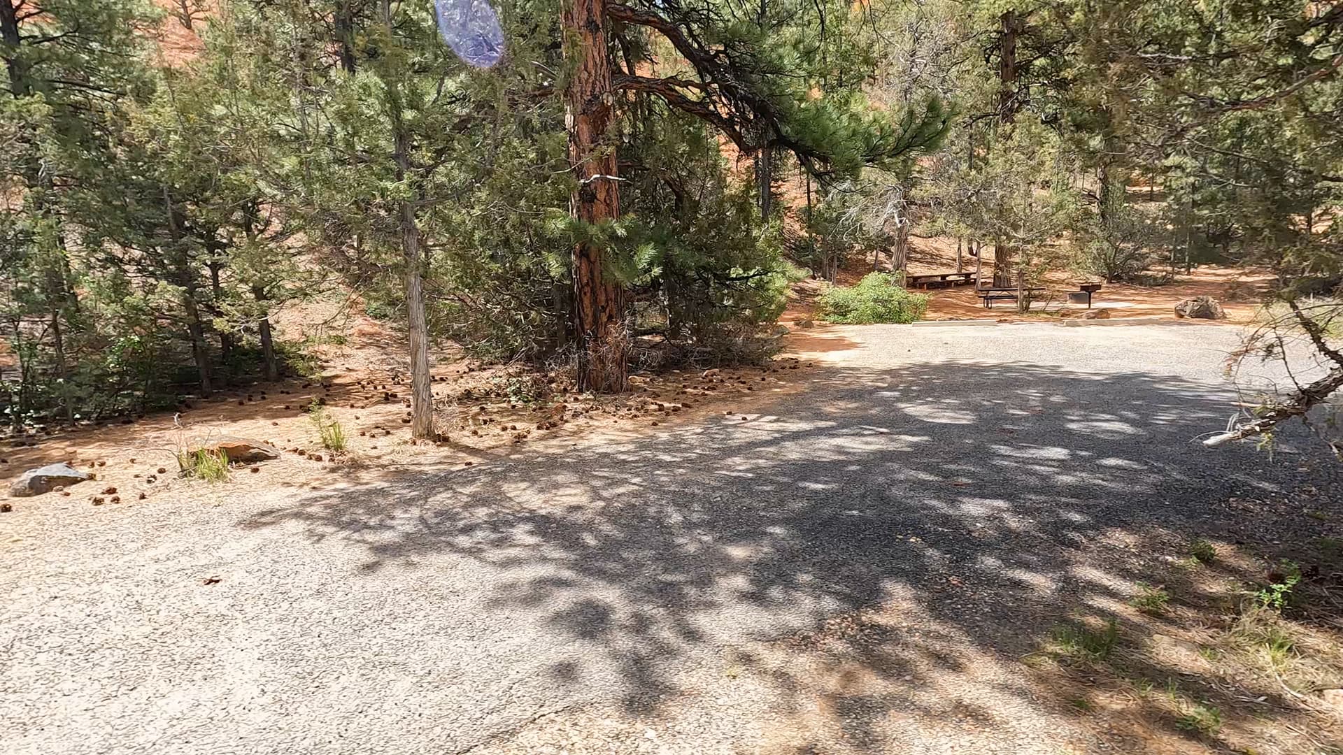
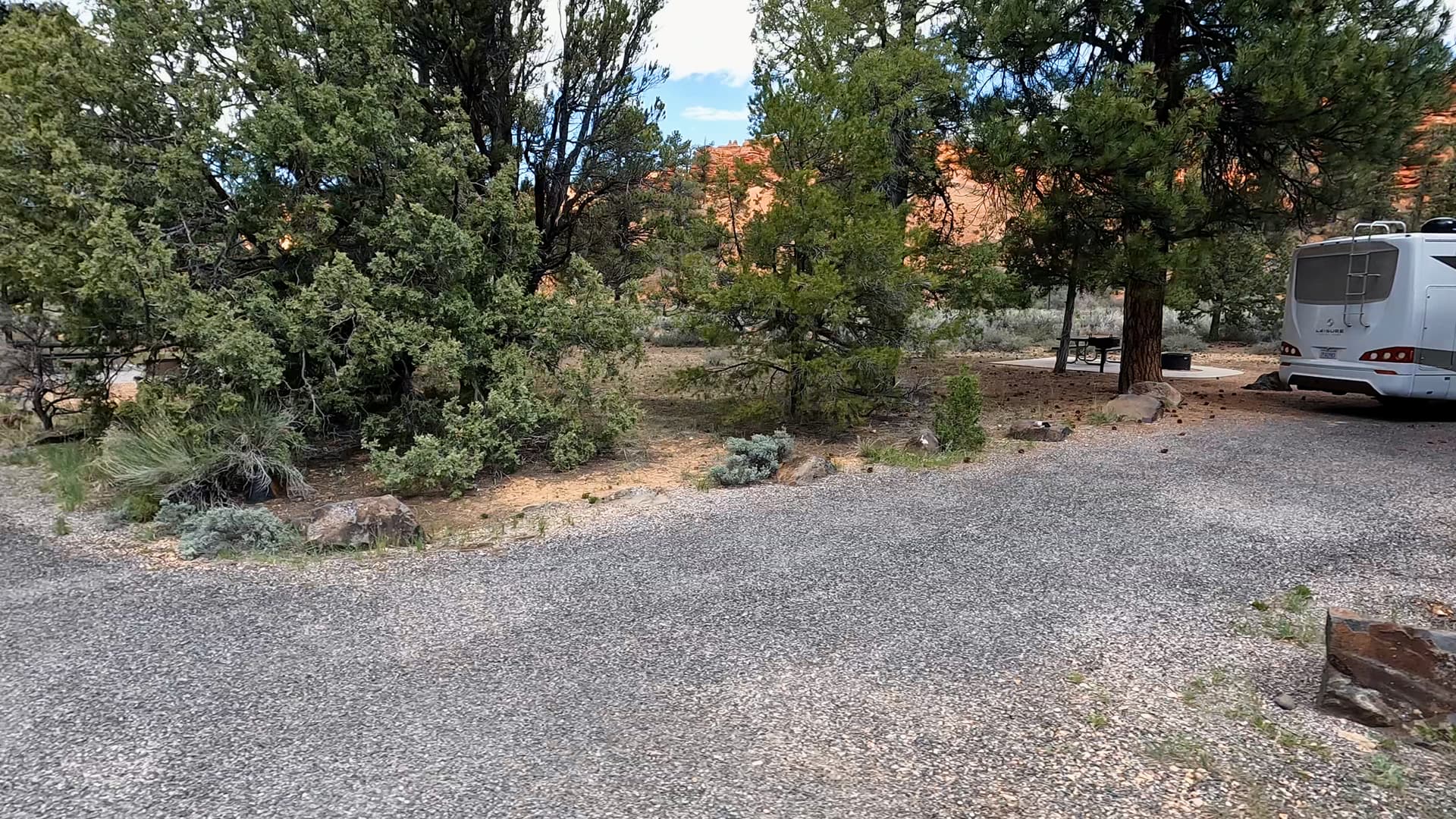
The campground lies within Red Canyon, a section of Dixie National Forest characterized by colorful sandstone cliffs, hoodoos, and high-elevation forest. Ponderosa pine trees provide shade throughout the area, creating a blend of forest and desert canyon scenery. At an elevation of roughly 7,400 feet, the climate is typically cooler than lower desert areas during the summer months. The canyon’s distinctive rock formations surround the campground and are visible from many nearby viewpoints and trails.

Campground Overview

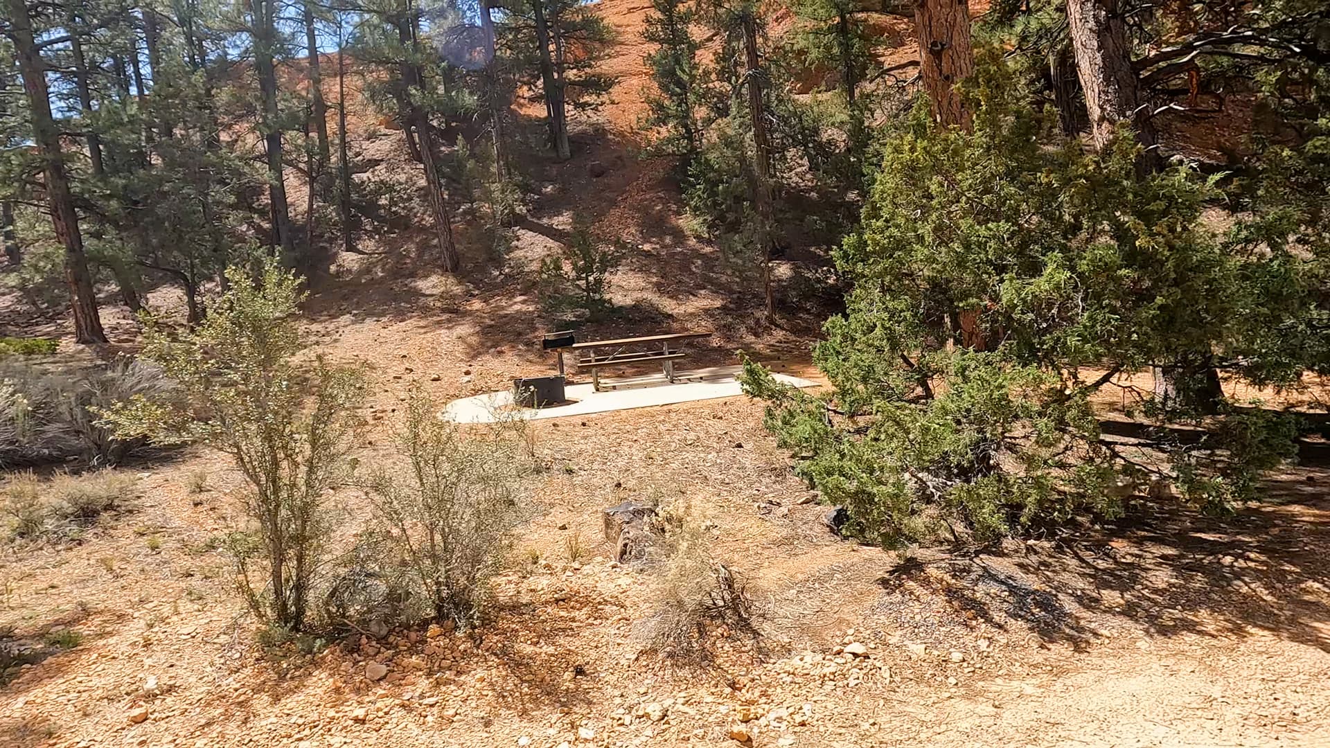
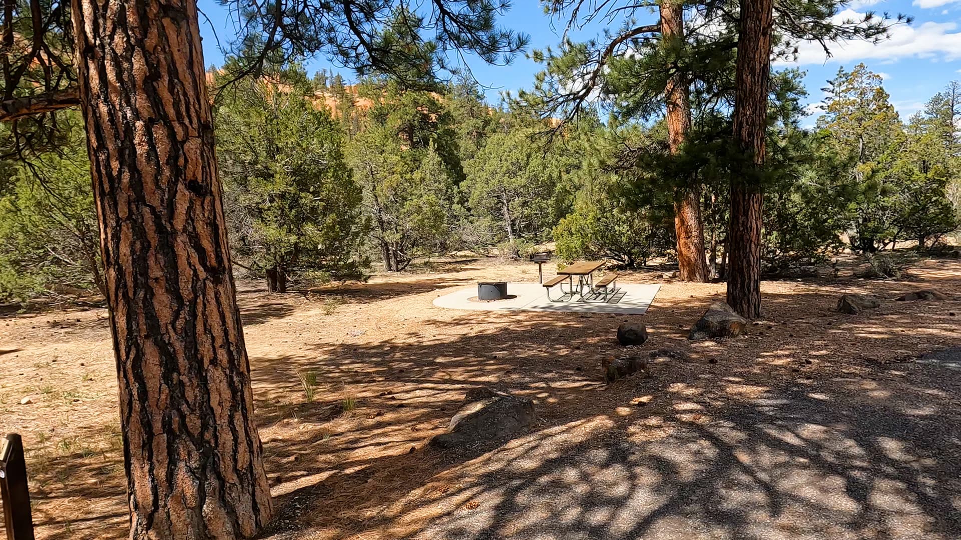
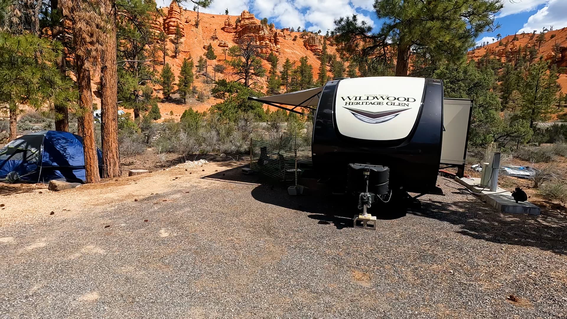
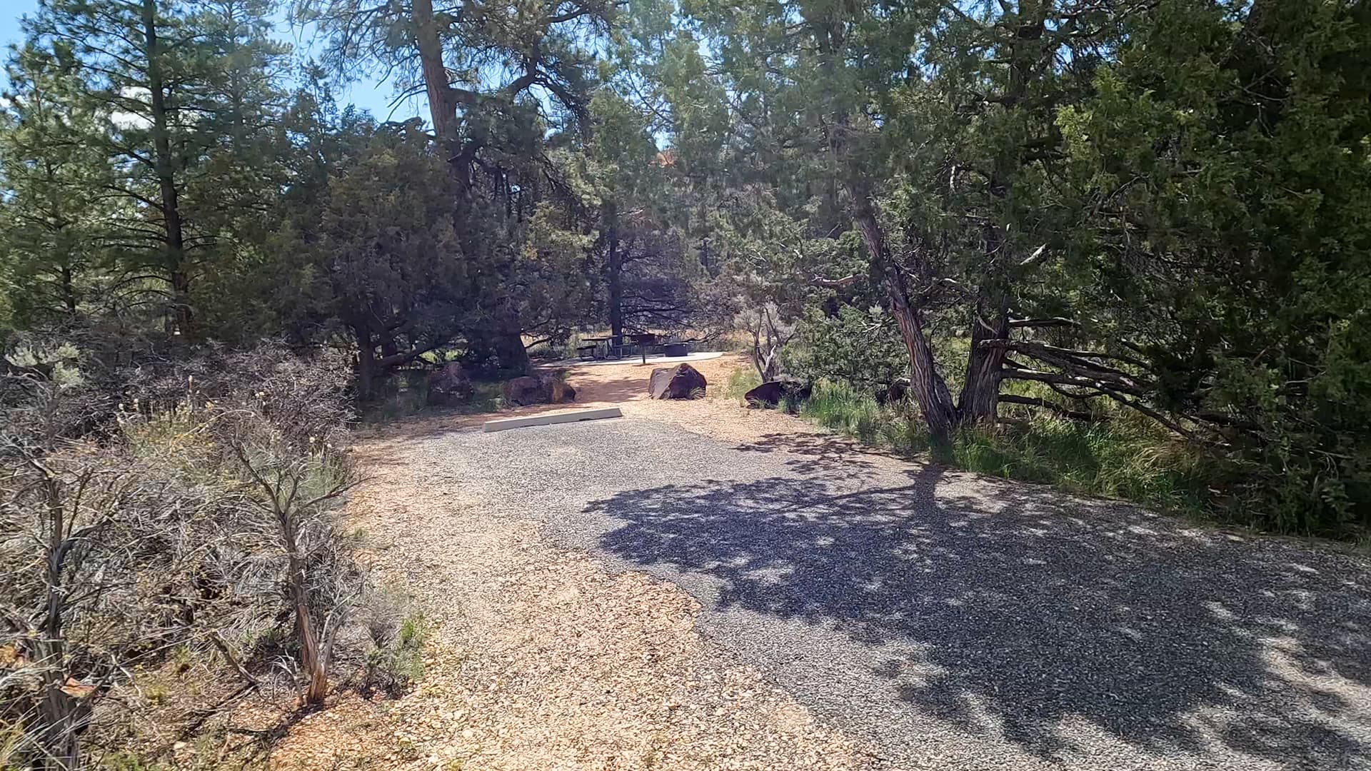
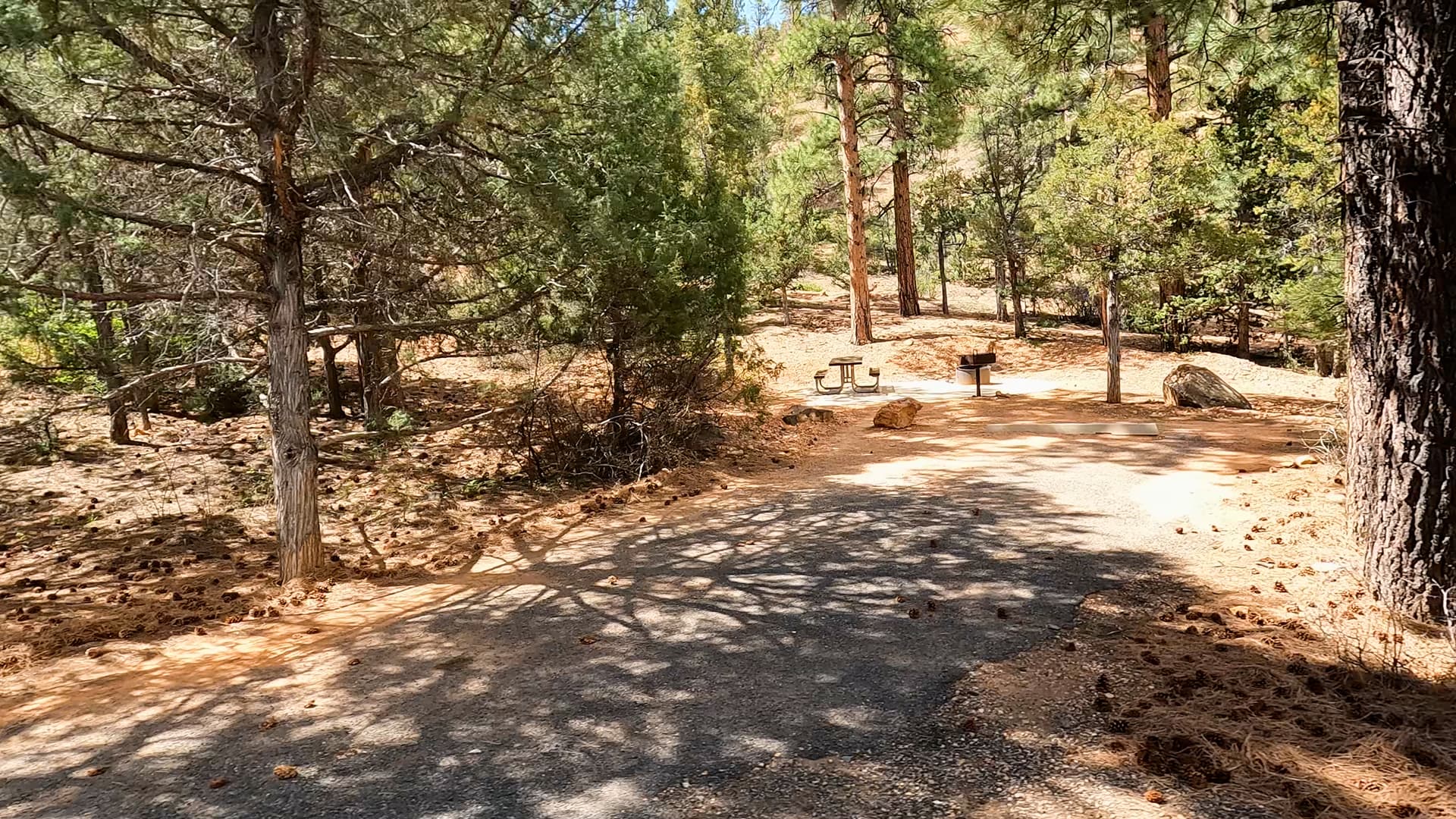
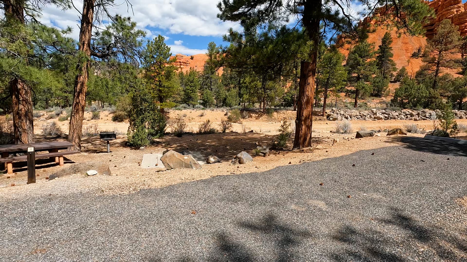
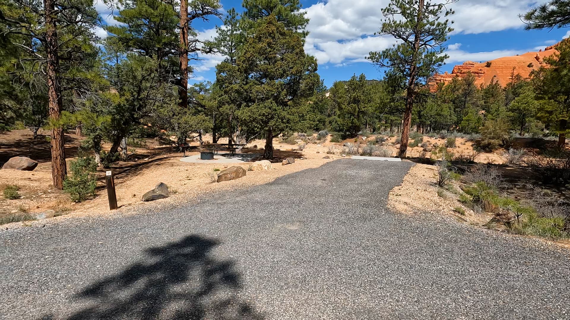
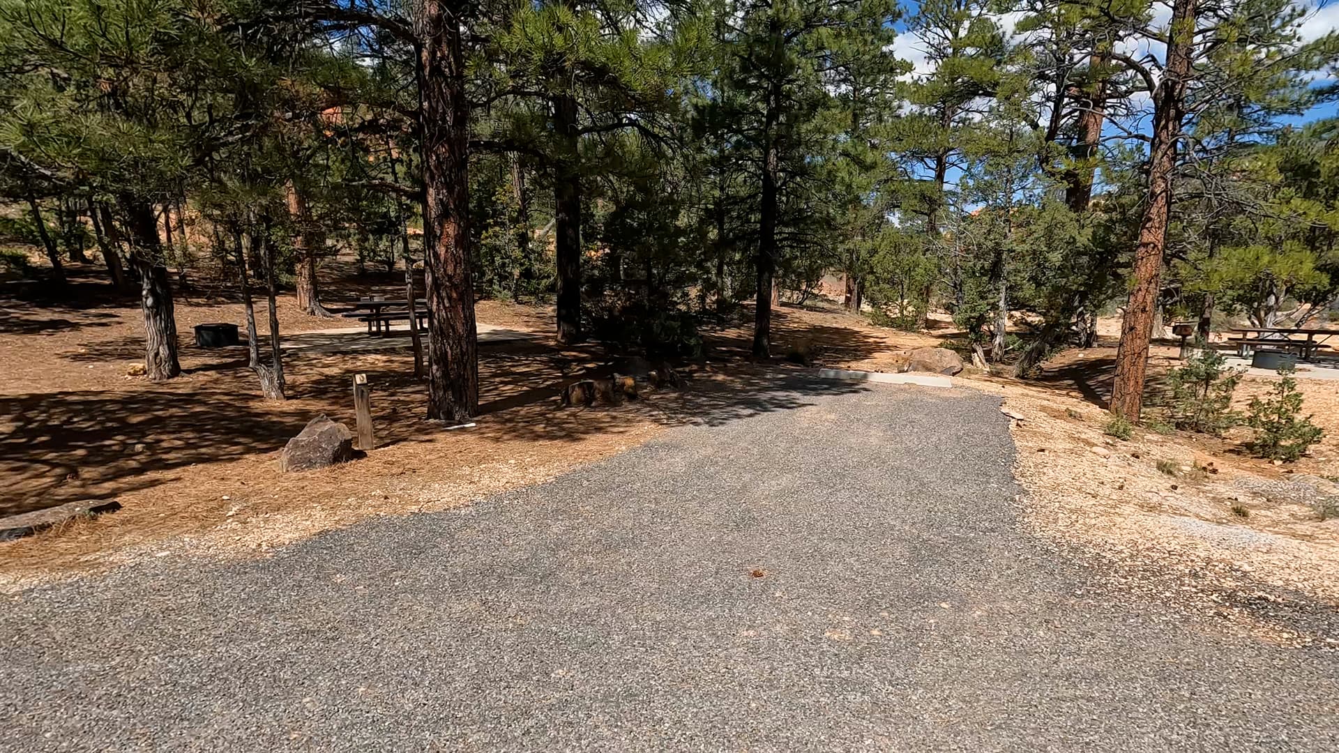
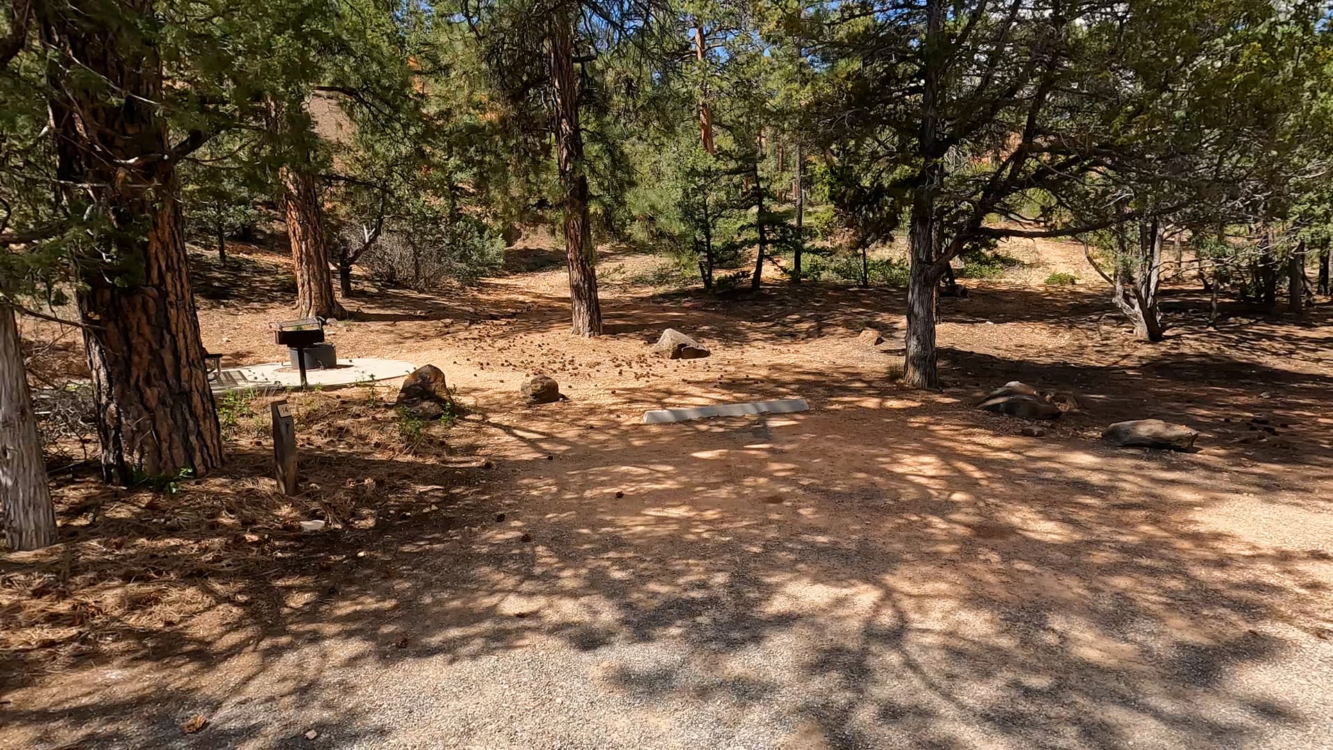
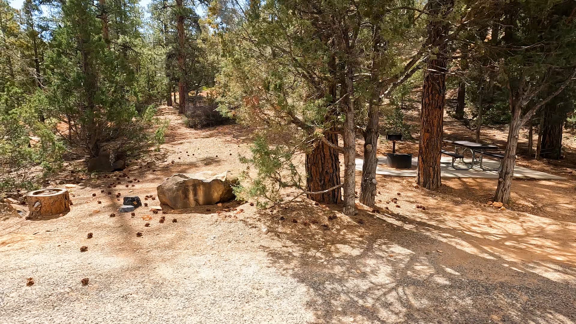
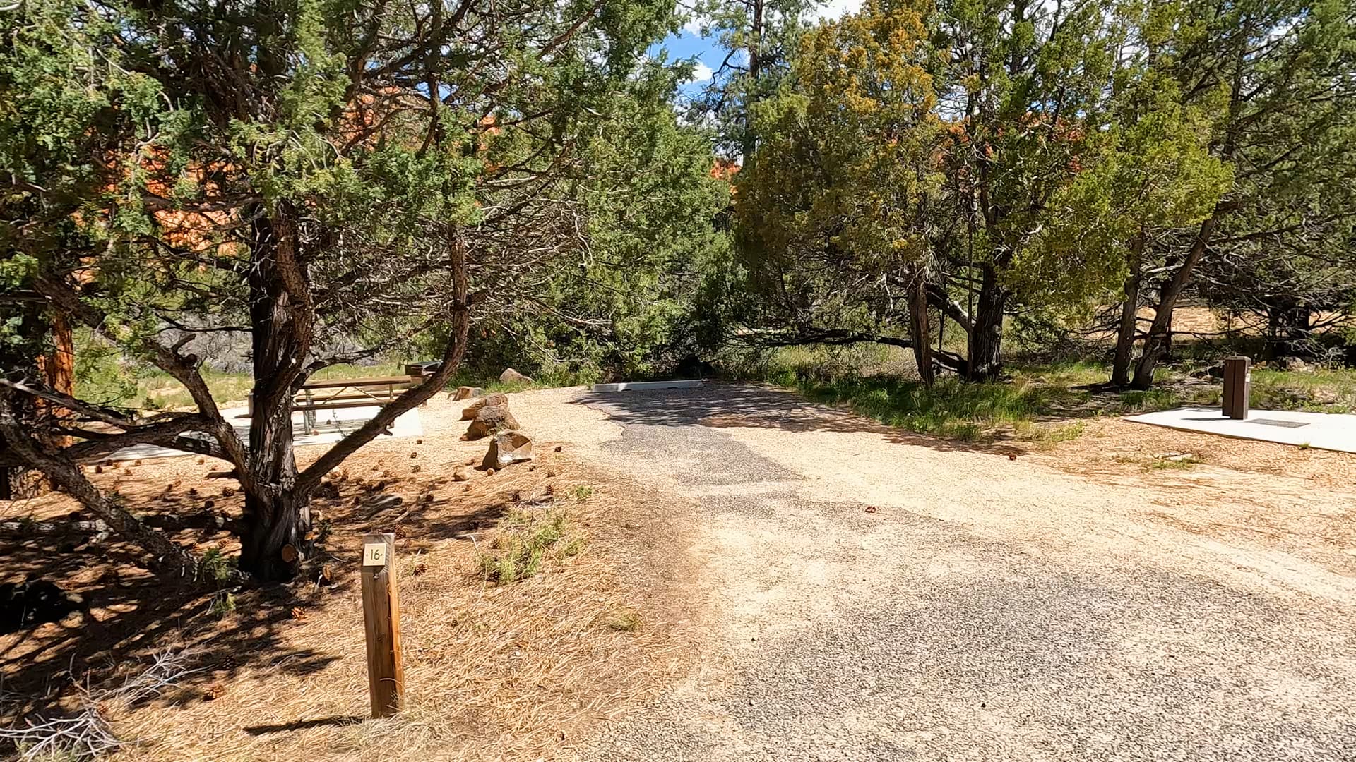
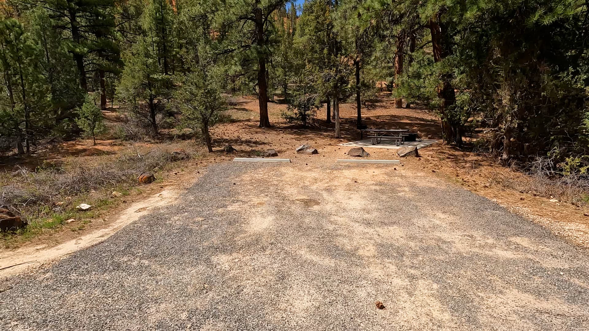
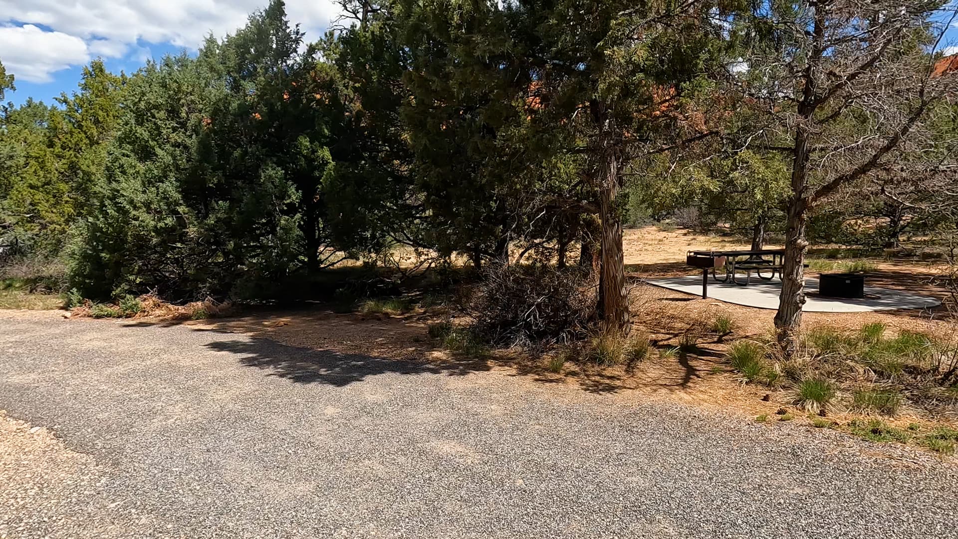
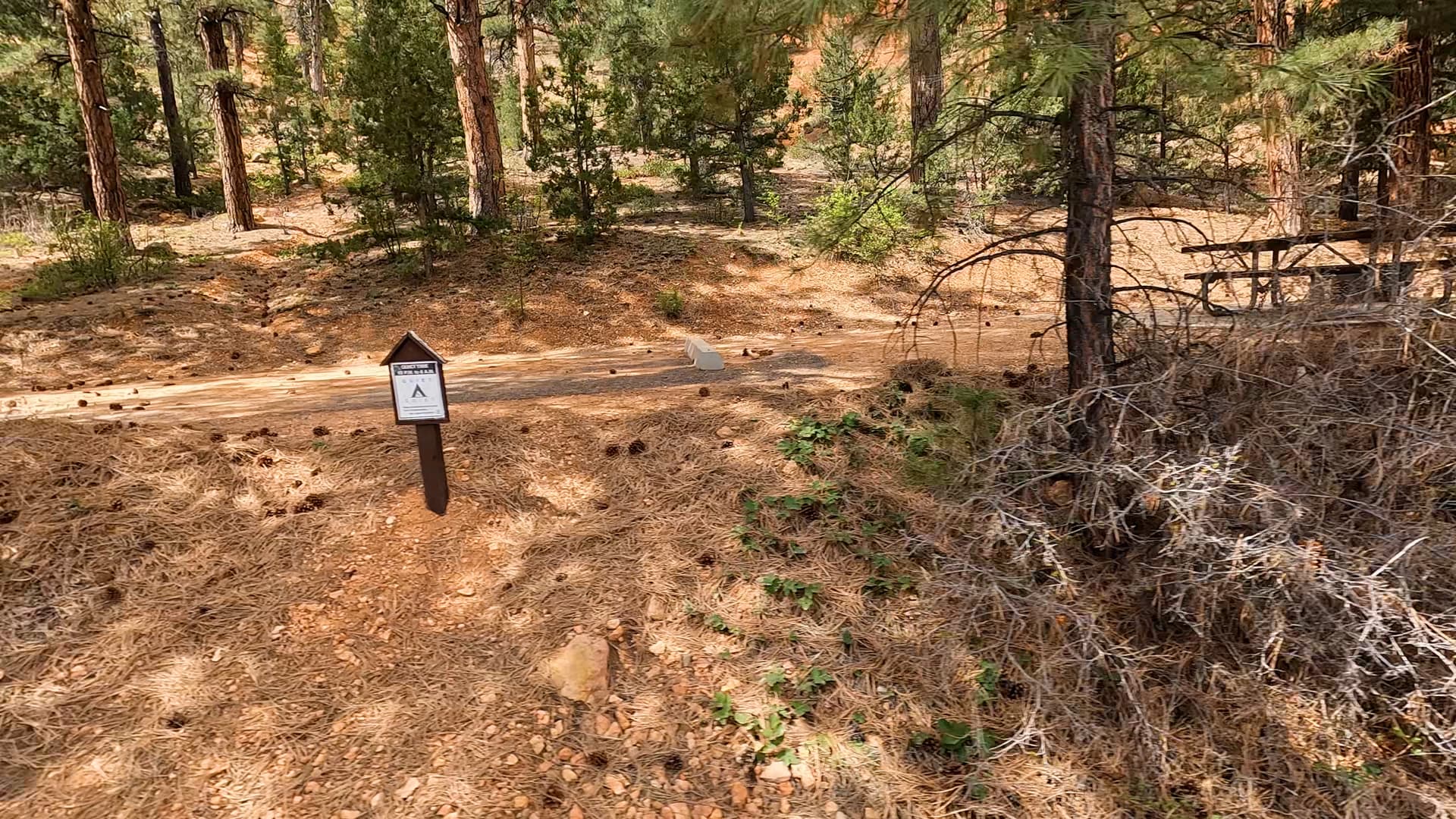
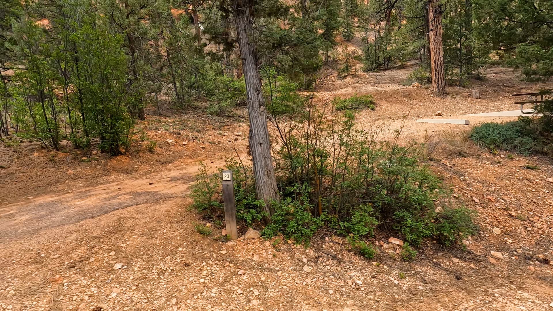
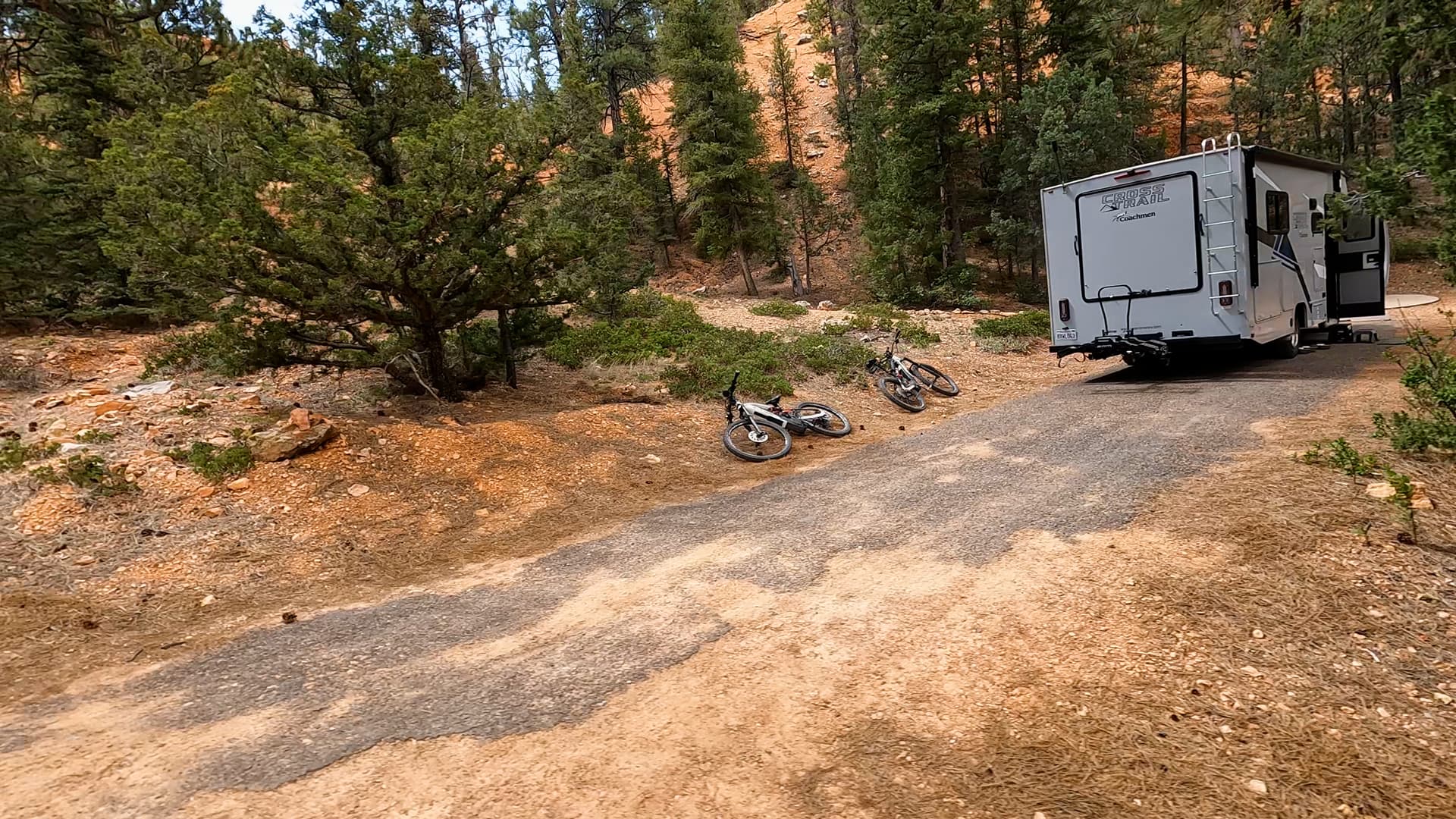
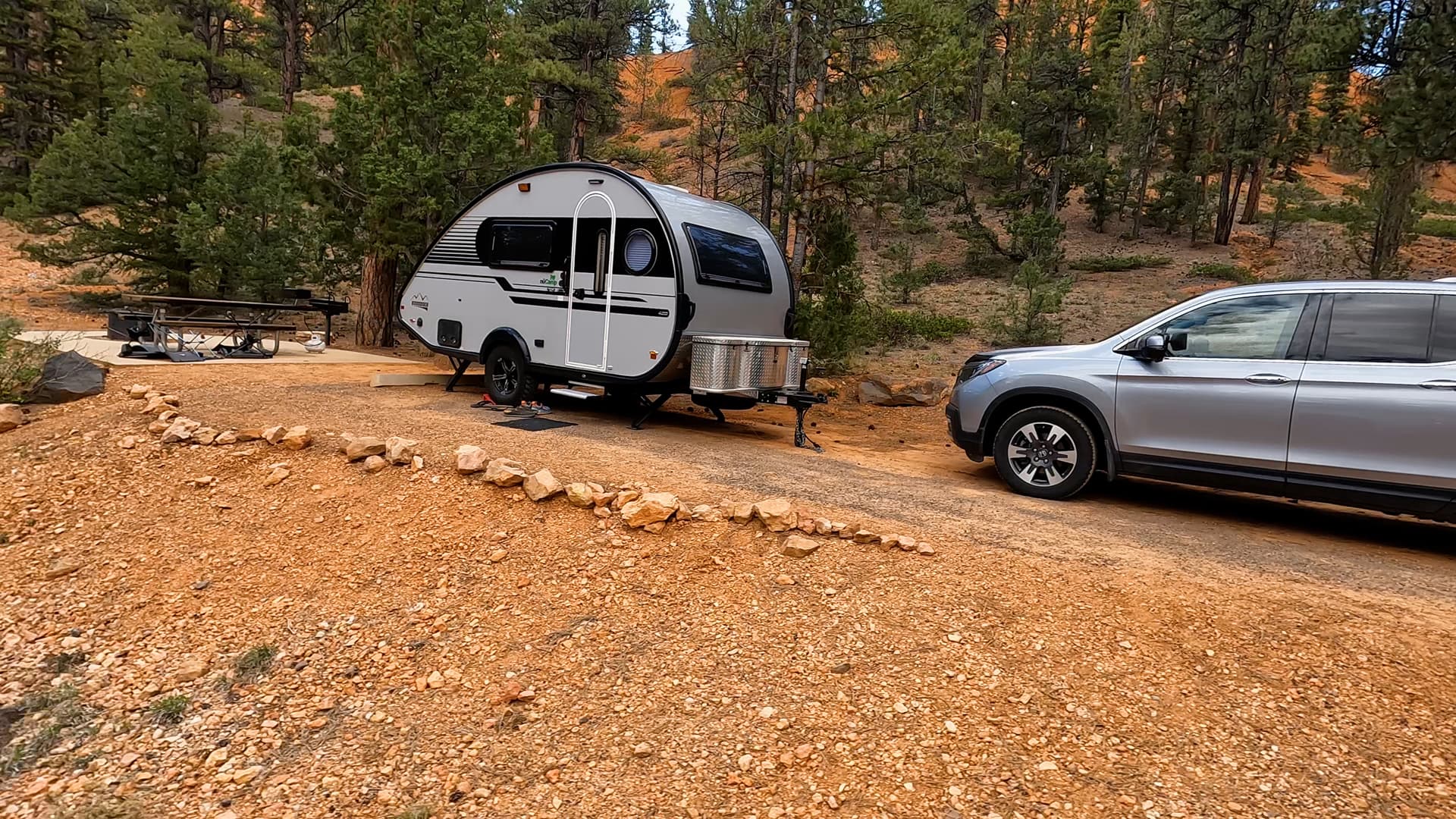
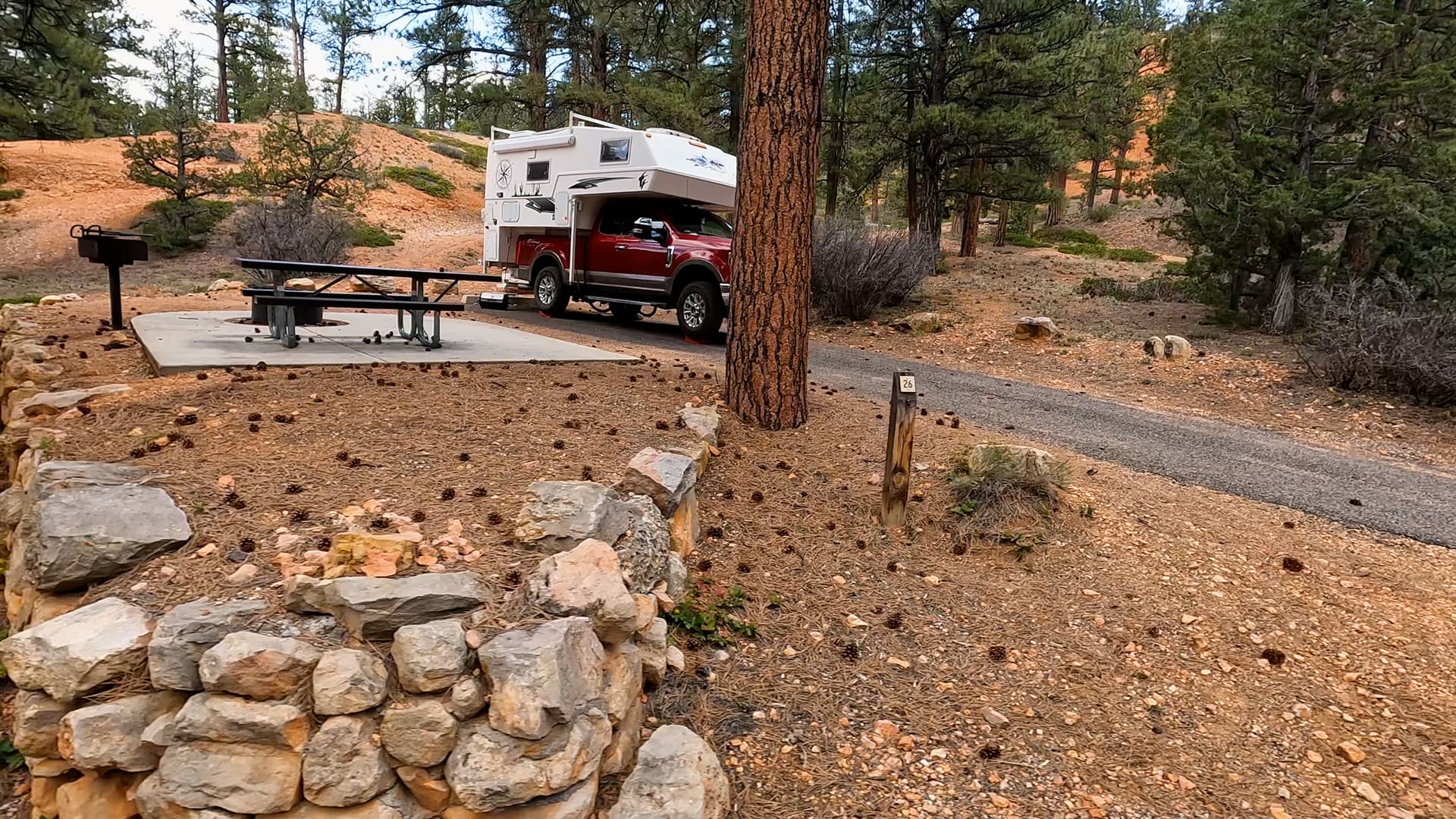
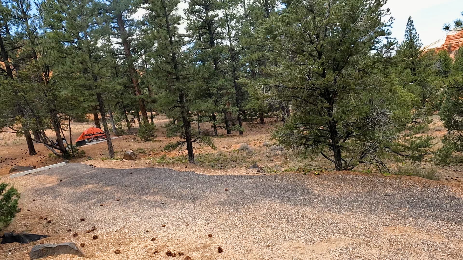
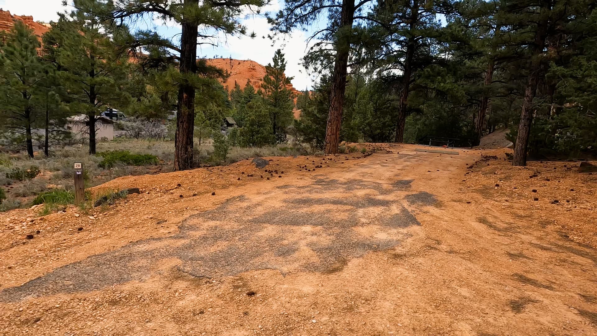
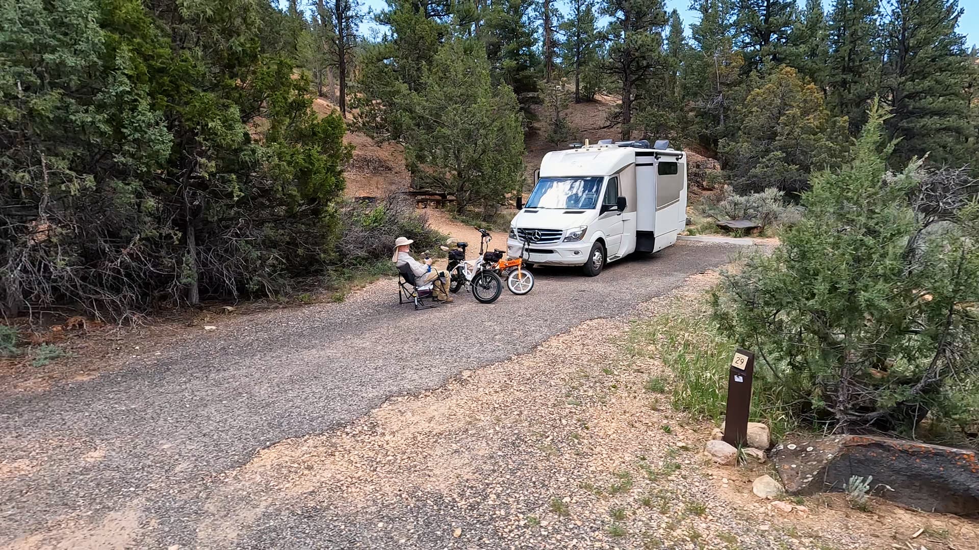
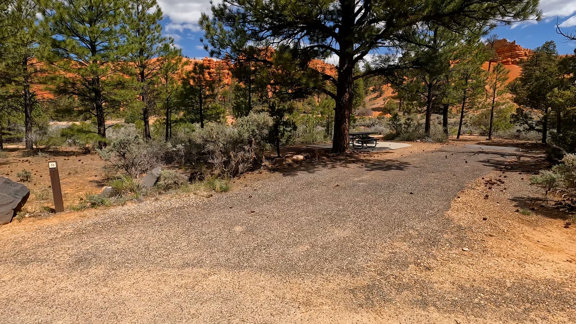
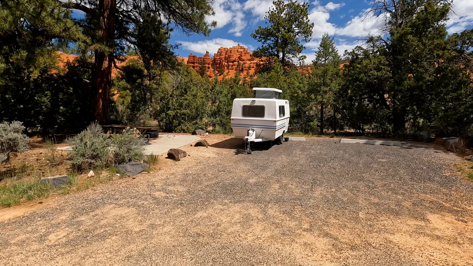
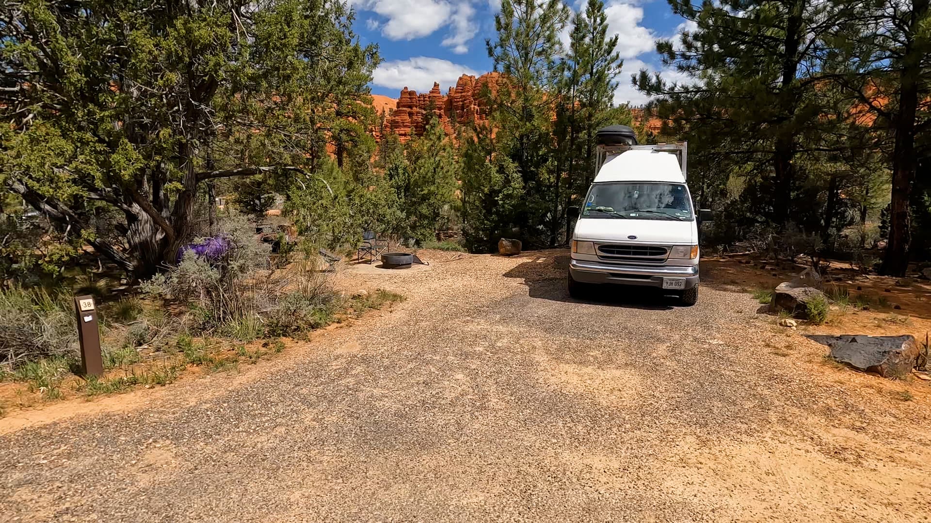
Red Canyon Campground is a moderately sized campground arranged along loop roads within the forest. Campsites accommodate both tents and RVs, though individual site sizes vary. The layout follows the natural terrain of the canyon, with trees and vegetation providing some separation between sites. The campground’s position along Scenic Byway 12 makes it easily accessible while still maintaining a natural setting among the canyon’s rock formations and forest.
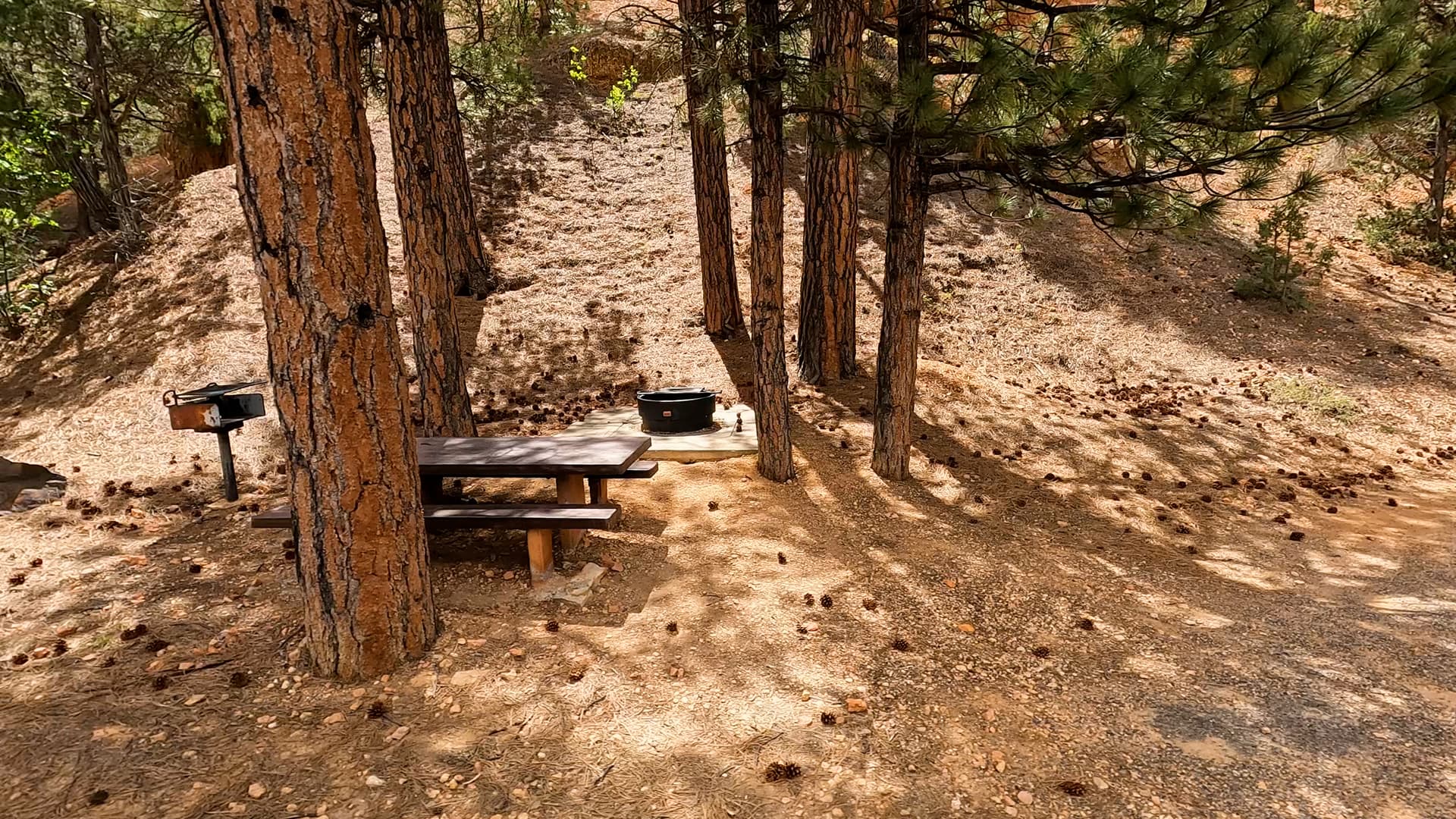
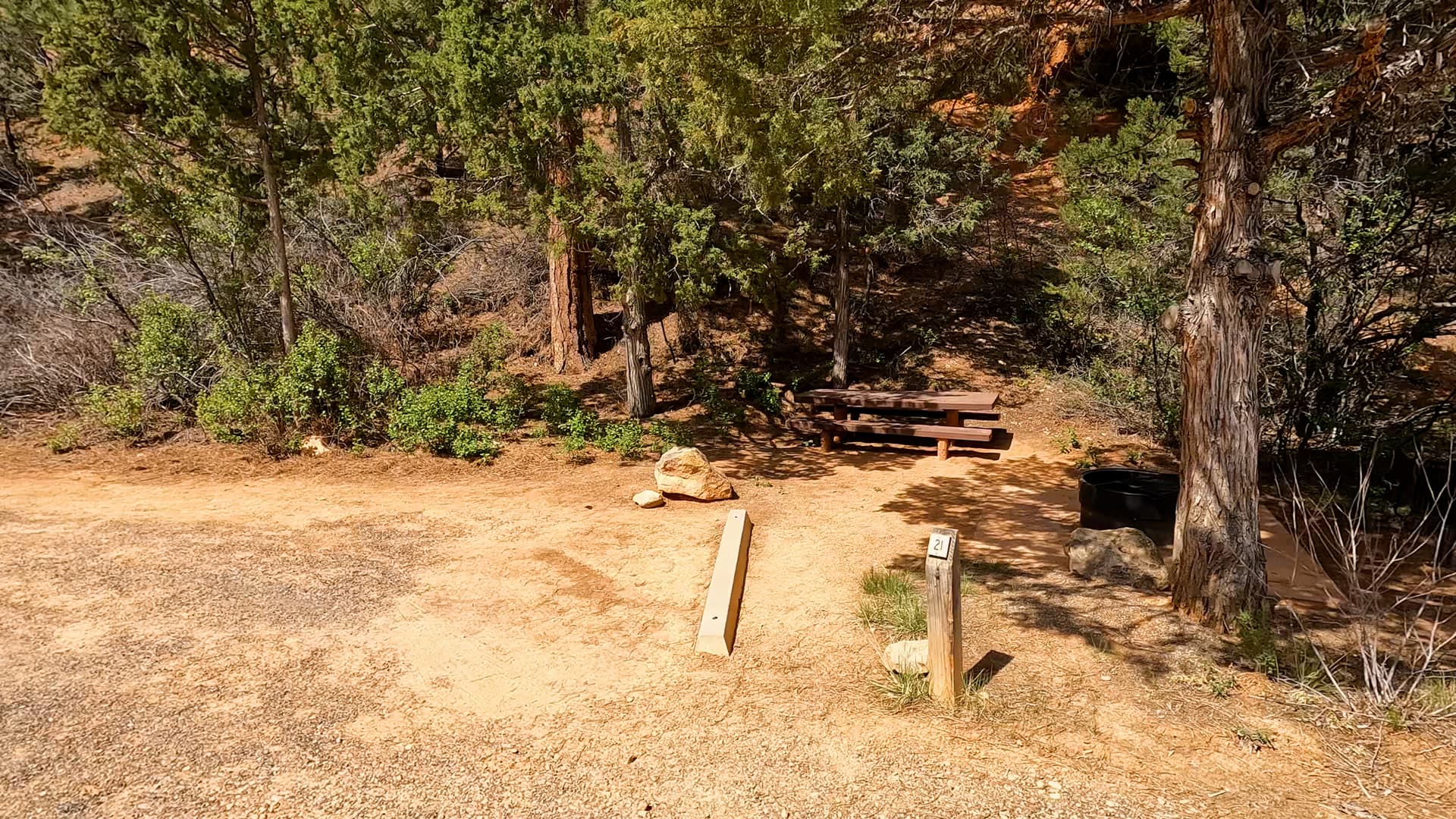
Amenities

Campsites include picnic tables and fire rings. Restroom facilities, showers, and potable drinking water are typically available during the operating season. There are no electrical, water, or sewer hookups at campsites, but there is a dump station. Campers should be prepared for a traditional national forest campground experience with limited services. Food storage and responsible campsite practices are encouraged to protect wildlife and maintain the natural environment.

Activities & Nearby Recreation

Red Canyon offers a variety of hiking and biking trails that wind through hoodoos and forested terrain. Scenic viewpoints and short interpretive trails allow visitors to explore the distinctive red rock formations up close. The campground’s location along Scenic Byway 12 also places it just a short drive from Bryce Canyon National Park, where visitors can experience the park’s famous amphitheaters and viewpoints. Photography, wildlife viewing, and scenic drives are common activities throughout the area.

Summary

Red Canyon Campground provides forested camping among red rock formations in Dixie National Forest near Bryce Canyon. With its scenic canyon setting and convenient access to nearby trails and Bryce Canyon National Park, it offers a picturesque basecamp for exploring southern Utah’s high desert landscapes.

Nearby Campgrounds